The Hike That Nearly Started on Someone's Farm
I need to get this out of the way first. We nearly did not find the trailhead. Our map sent us down a dirt road that ended at a gate with "Private Property" on it. My wife and I sat in the car staring at each other, both too stubborn to admit we were lost, until she pulled up AllTrails and found the actual start point about five minutes further along the main road. Lesson learned: download the AllTrails map before you leave phone reception.
Into the Rainforest
The trail starts in dense forest and it is immediately beautiful. Tall eucalyptus trees, ferns shoulder-high on both sides, mossy trunks covered in lichen. The light filters through the canopy in that particular Tasmanian way where everything looks like it was lit by a set designer. The path is well-worn and mostly flat for the first 20 minutes or so, following blue trail markers nailed to trees.
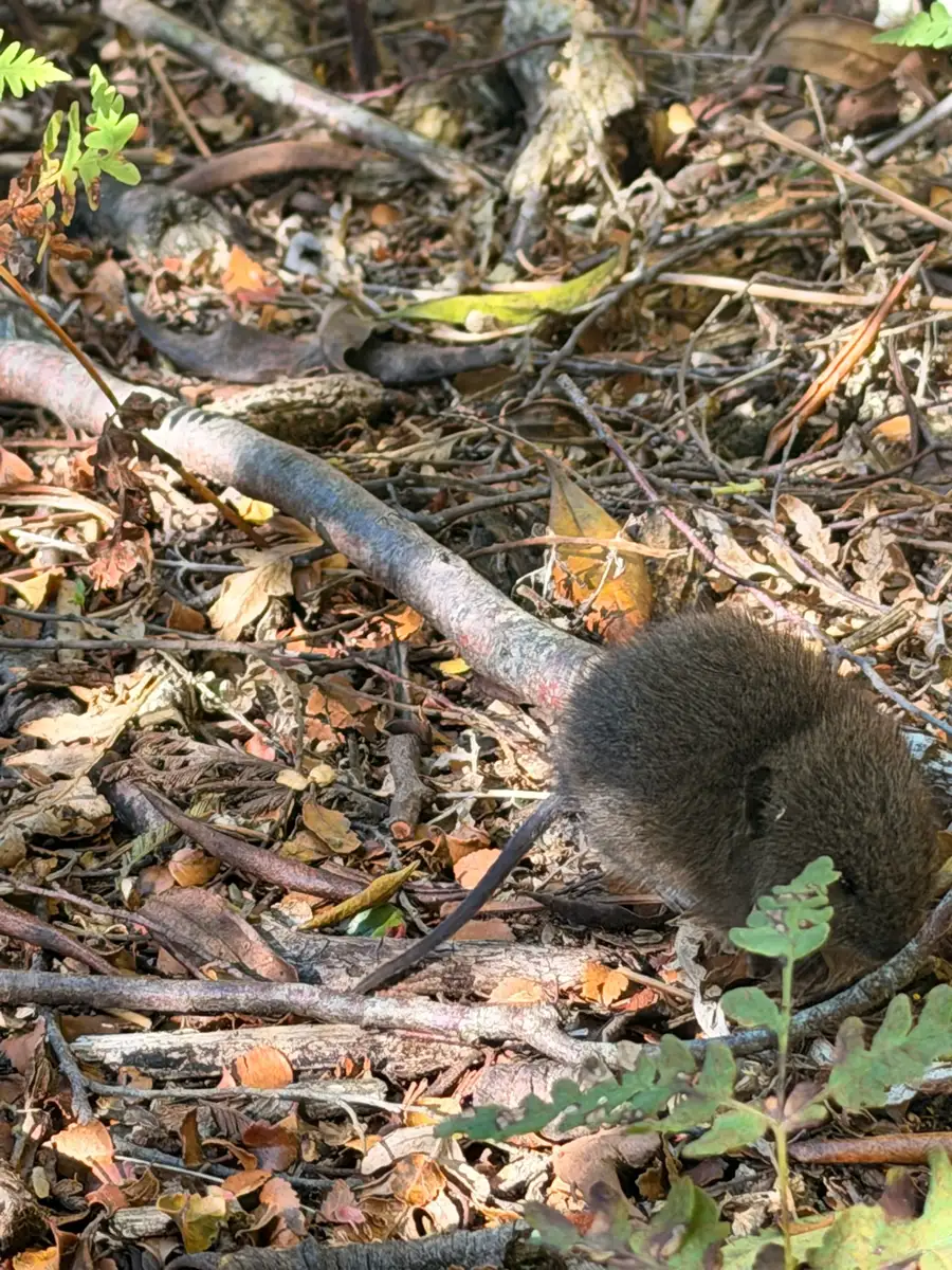
We spotted a potoroo first thing in the morning, just off the trail in the undergrowth. Tiny thing, gone in a flash. Then about 15 minutes in, a native rat sitting right in the middle of the path, completely unbothered by us walking past. My wife called it "cute." I would go with "surprisingly bold."
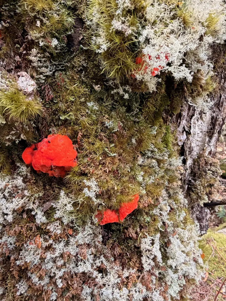
The fungi were everywhere. Red ones the size of a 50-cent coin growing off mossy bark. Yellow clusters on fallen logs. Massive brown shelf fungi bulging out of tree trunks. If you are into fungi photography, bring a macro lens and give yourself an extra hour.
The Boulder Field
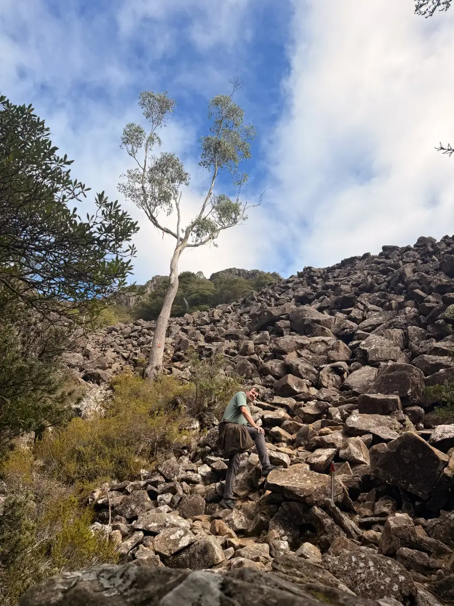
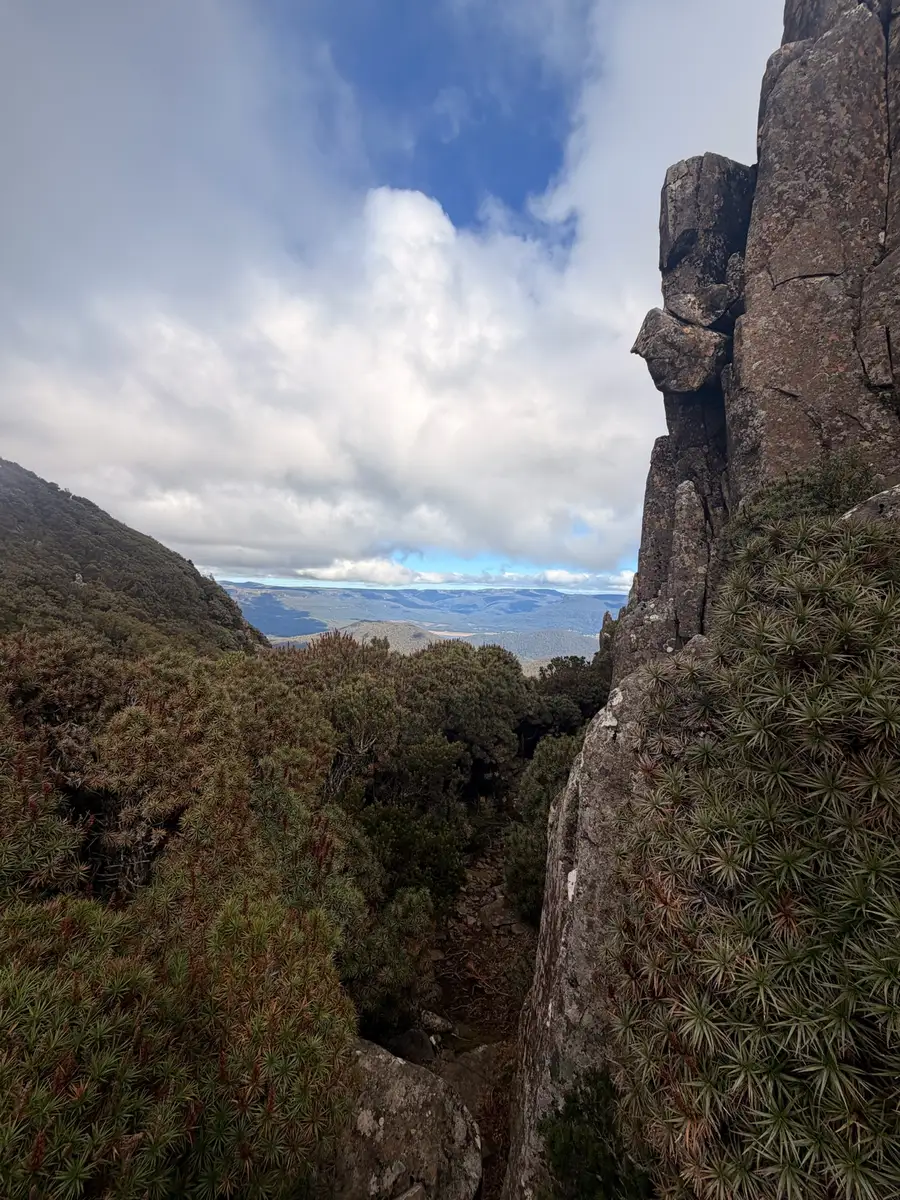
About 2km in, the forest opens up and you hit the boulder field. This is where the hike changes character. The rainforest gives way to a massive scree slope of dark dolerite boulders stretching up towards the summit. A single eucalyptus tree clings to the rock about halfway up, which makes for a great photo and a useful marker for how far you have to go.
The scrambling here is not technical, but it is physical. You are picking your way up and over large rocks, using your hands to steady yourself, choosing your route as you go. It lasts about 5 to 10 minutes and is the section most people would struggle with if they have knee issues or are not comfortable on uneven ground. Take your time. There is no rush and the views behind you get better with every metre of elevation.
The Summit Push
After the boulder field, the trail steepens through a final stretch of scrubby forest before you reach the dolerite columns near the summit. These tall rock formations look like someone stacked massive stone blocks on top of each other. The trail threads between them and there are a couple of spots where you need to actually climb. Hands on rock, pulling yourself up over a ledge. Nothing dangerous if you are careful, but it would be genuinely sketchy in the wet.
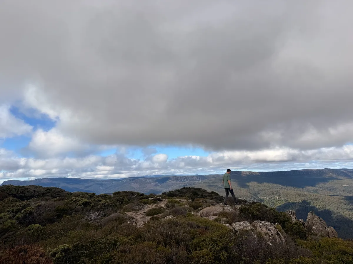
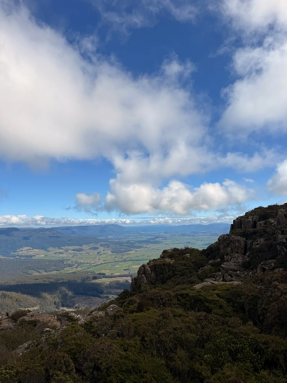
The Top
Then you break through onto the summit plateau and everything opens up. 360 degrees. The whole of northern Tasmania laid out below you. Green farmland, the Great Western Tiers stretching east and west, Deloraine looking like a toy village, and on a clear day you can apparently see all the way to Bass Strait and even Flinders Island, 200km away.
We could not quite see the coast on our day. The clouds were dramatic but thick in the distance. Still, the view was extraordinary. We found a flat rock, sat down, and just stared for a while.
The summit is a broad plateau with alpine scrub, cushion plants, and plenty of flat rocks to sit on. There is enough space up there for 20 people to spread out without being on top of each other. We saw five other groups on the whole hike, and only two of those were on the summit at the same time as us.
Bring a picnic and eat it at the summit. There are perfect spots for it: flat rocks with views in every direction. Just be prepared for wind. It was blowing steadily when we were up there and I was glad I had my jacket.
The Descent
Going down was faster but harder on the knees. The boulder field section requires even more care on the way down because you are looking at your foot placement from above and the rocks are not always stable. I would not want to rush this section. We did the full return in about 3 hours and 15 minutes including a solid 20 minutes on the summit.
The Little Shrub Birds
Something I did not expect: the birdlife near the summit was excellent. Small shrub birds darting between the alpine bushes, completely at home in the wind. I do not know the exact species, but they were everywhere once we got above the tree line. If you are a birder, the AllTrails page mentions it is a popular birding spot and I can see why.
New dispatches from the field
Real stories. No spam. Unsubscribe anytime.