
Things I Wish Someone Told Me
Use AllTrails for directions, not Google Maps. Google Maps will try to send you down a road that ends at private property. We wasted 15 minutes figuring out we were in the wrong place. Search 'Quamby Bluff Trail' on AllTrails and follow the GPS.
Bring water. We forgot. It is a steeper hike than it looks on paper, and by the time you are scrambling up the boulder field you will be wishing you had a drink. No water sources on the trail.
The parking is small. Maybe 10 to 15 cars. Get there by 9am on weekends and holidays or you may end up parked on the road verge.
Long pants, not shorts. The alpine scrub at the summit is spiky. Bare legs will get scratched up if you explore the plateau beyond the main track.
Weather
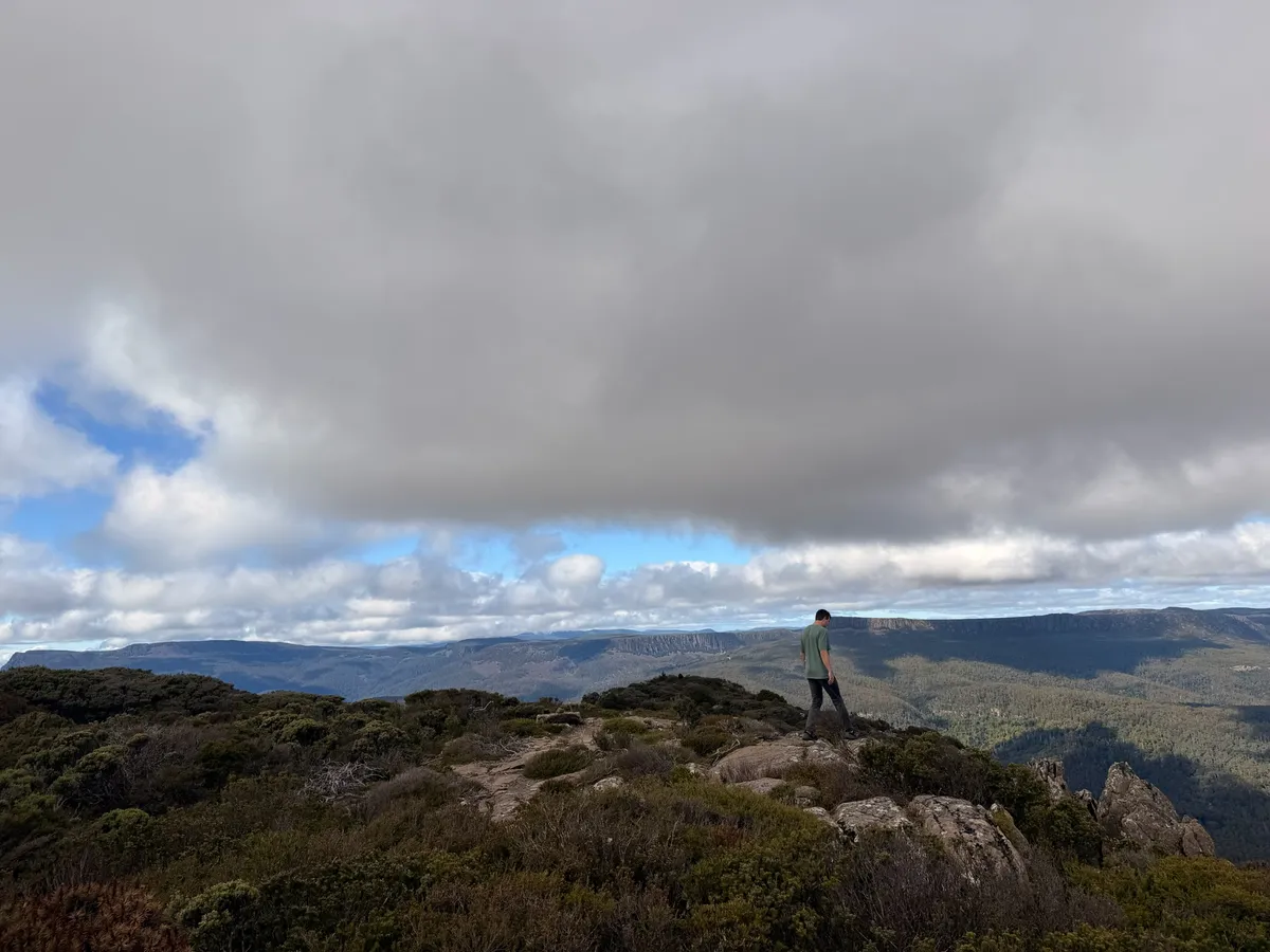
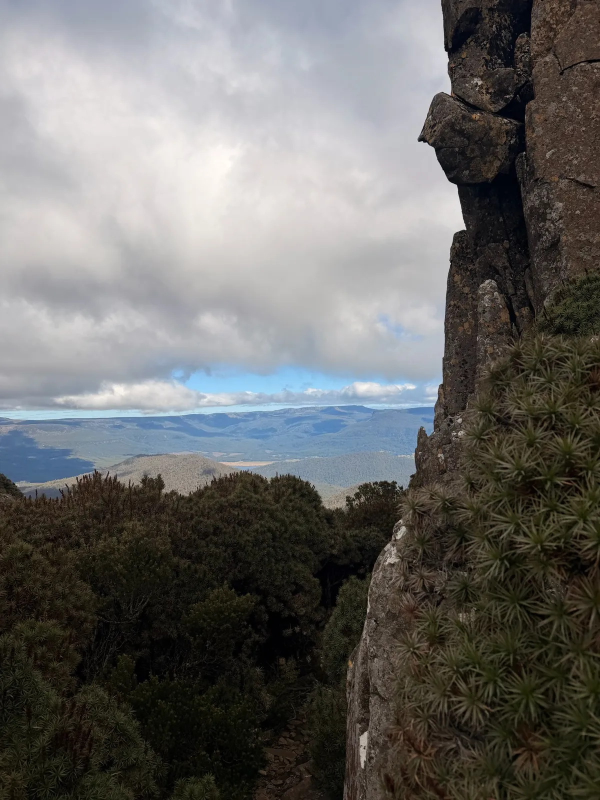
If it is raining, skip it. The boulder field and the rock climbing near the summit would be genuinely dangerous when wet. The views from the summit are the payoff for the climb, and you will not see anything through cloud and rain.
Tasmania's weather changes fast at altitude. We started in sunshine and had cloud rolling in by the time we were descending. Bring a windbreaker even if the forecast says clear. At 1,227m the wind chill can drop the temperature significantly, and you will be standing exposed on a plateau with zero shelter.
The best months are October through April when conditions are warmest and driest. Winter hiking is possible for experienced walkers, but the summit can get snow and ice. Summer (December to February) gives you the longest daylight and best chance of clear skies.
Safety
Boulder field: Take your time. The main injury risk on this hike is a twisted ankle or a fall on the boulder field. The rocks are not always stable. Test your footing before committing your weight.
Summit climbing: The short rock faces near the summit (1 to 2 metres high) require you to pull yourself up with your hands. This is not difficult for most people, but it would be dangerous if the rock is wet. Do not attempt in rain.
Snakes: We did not see any, but this is Tasmania and they are around, particularly in warmer months. Stick to the trail where visibility is good and make noise as you walk through the forest sections.
Horse flies: Some AllTrails reviewers mention horse flies at the summit. We had none in April, but summer hikers should bring repellent just in case.
Phone reception: Patchy at the car park, non-existent on the trail. Let someone know where you are going and when you expect to be back.
What to Do After the Hike
This is where Quamby Bluff really shines as a day trip. The area around Deloraine is packed with good food and things to do.
Christmas Hills Raspberry Farm: Five minutes west of Deloraine on the Bass Highway. They do raspberry pancakes, sausage rolls, and every raspberry product you can imagine. Great coffee. Overlooks a lake. Perfect post-hike lunch spot. This is where we went and I would go back every time.
Van Diemen's Land Creamery: Right next door to the Raspberry Farm. 24 flavours of ice cream. Not a hard sell after a 3-hour hike.
Deloraine itself: Small town, genuinely charming. Walk along the Meander River and look for platypus. Waterbirds, geese, and pigeons along the banks. Public toilets available. Several good cafes for coffee.
Trowunna Wildlife Sanctuary: About 12 minutes west towards Mole Creek. You can see Tasmanian devils up close, with feeding tours three times a day. Worth the stop if you have not seen devils elsewhere.
Mole Creek: Keep driving west and you hit Mole Creek, which has a well-regarded pub for lunch and the Mole Creek Karst National Park with its limestone caves.
Liffey Falls: About 30 minutes southeast. A flat 2km walk to a stunning multi-tiered waterfall. Easy enough to do as a second hike on the same day if your legs are not too tired.
Common Mistakes
- Going to the wrong car park. Use AllTrails, not Google Maps.
- Not bringing water. There is none on the trail.
- Wearing shorts. Summit scrub will scratch your legs.
- Skipping the jacket. Summit wind is real even on warm days.
- Starting too late. Parking fills up and afternoon cloud rolls in. Start by 9am.
- Rushing the boulder field. This is where people get hurt. Slow and steady.
New dispatches from the field
Real stories. No spam. Unsubscribe anytime.