The Actual Days: What Happens When
The South Coast Track isn't a linear difficulty curve. Some days are harder than others based on terrain, weather, and how your body is adapting. The guidebook times are optimistic. The reality is slower. Here's what a realistic 10-day South Coast Track itinerary looks like based on two completions in different conditions.
Day One: Melaleuca to Cox Bight (12-14 km)
You'll start in the afternoon after your Par Avion flight and meeting the ranger. The walk from Melaleuca to Cox Bight is relatively easy terrain but you're still acclimatising.
The track leaves the airstrip heading south. The first few kilometres are on a well-maintained path through buttongrass plains. It's deceptively gentle. You'll think, "This isn't so bad." Give it three hours. The challenge on day one is just getting moving with full weight on your back. Your shoulders and hips will complain. This is normal. Your body hasn't figured out the weight distribution yet and the hip belt is still finding its groove.
By late afternoon, you'll reach Cox Bight. There's a camping area here. Water is available. The beach is sandy. This is a good first camp but the tide situation means you might camp here longer if the crossing isn't optimal.
I camped here on my first trip and fought the incoming weather. The wind came in off the coast and my Kmart tent flapped so hard I thought the poles would snap. I lay there staring at the ceiling, listening to the rain, eating cold pasta because I couldn't be bothered setting up the stove in the wind. That was the first moment I questioned the whole trip.
Second trip with my partner, same campsite, completely calm. We cooked dinner, watched the sunset, and she said, "This is nice." Same place. Totally different experience. The variation matters.
Distance: 12-14 km Elevation gain: Minimal, maybe 200m Difficulty: Easy Terrain: Track, beach Sleep quality: Moderate (you're excited and anxious) Food: Normal supplies
Day Two: Cox Bight Tidal Crossing to Granite Beach (14-16 km)
This depends entirely on tidal timing. The crossing at Cox Bight can only be done at low tide. If you misjudged the timing (like I did on trip one), you'll burn hours sitting on a beach watching the water and kicking yourself.
I arrived at the crossing as the tide was still coming in. Sat there for three hours watching the swell grow. Had plenty of time to think about whether I'd made a scheduling error or just bad luck. Turns out: bad planning. The tidal times are in the guidebook. I'd read them but not properly accounted for my walking pace. Lesson: work backwards from the low tide window and plan your departure time accordingly.
The actual crossing is a few hundred metres of exposed beach. When the tide is right, it's straightforward. When the tide is coming in, the swell gets bigger and the rocks become slippery. Judge this carefully. If you're unsure, wait. There's nothing on the other side that's worth risking a wave sweep for.
Once across, you're on coastal track towards Granite Beach. The terrain is sandy and rocky. Wind exposure increases as you head south. My first trip, the wind picked up around 2pm and didn't stop for the rest of the day. It was the first time I understood that "exposed" means "no trees between you and Antarctica."
By afternoon, you'll reach Granite Beach and establish camp. This is where you might first really feel the cold. If weather is moving in, it'll be obvious by late afternoon. On my first trip, I watched a storm front roll in from the south-west and knew I was in for a rough night.
Distance: 14-16 km Elevation gain: 200m Difficulty: Moderate (tidal timing stress) Terrain: Beach, rocky track Sleep quality: Poor if weather is bad (like mine was) Food: You might not sleep, so nutrition matters less
Days Three to Five: Ironbound Range to Granite Beach Camp to Iron Bound Beach
This is the hardest section. You're now climbing into the Ironbound Range. The elevation gain is real. The exposure is real. The weather is unpredictable.
Day three will be your push into the range. The track climbs steadily. By midday, you're among the peaks. The temperature drops. The wind increases. Sleet is possible even in summer. By the time you're descending towards Granite Beach camp, you're exhausted.
This is 8 to 10 hours of walking. Your legs burn. Your shoulders hurt from the pack. Your mind is starting to simplify into just "keep moving forward." I remember stopping at one point on day three, sitting on a rock, and just staring at the ground for about five minutes. Not thinking. Just existing. The exhaustion had pushed past the point where my brain could generate worry. It was just: stand up, walk, repeat.
The Ironbound Range is also where you'll see the most dramatic weather shifts. I started day three in light drizzle and by midday was in genuine sleet with visibility down to maybe 50 metres. You can watch a storm front approach from the exposed ridgeline and there's absolutely nothing you can do except put your hood up and keep moving.
Days four and five are variable. If weather is good, you'll move quickly. If weather is bad, you'll move slowly and stop early. The track from Granite Beach camp towards the southern end of Ironbound Range is steep, exposed, and potentially dangerous in bad conditions.
I took almost five hours to do sections the guidebook says take three hours. Mud was deep. Visibility was poor. Exhaustion was significant.
But once you're past Ironbound Range and heading towards Iron Bound Beach, the sense of accomplishment is enormous. You've made it through the hardest section. Everything ahead is easier.
Days three to five combined: - Total Distance: 35-40 km over three days (variable) - Total Elevation: 1000+ metres - Difficulty: Hard - Sleep Quality: Moderate (exhaustion helps, but cold doesn't) - Food: Maintain calories, you're burning them
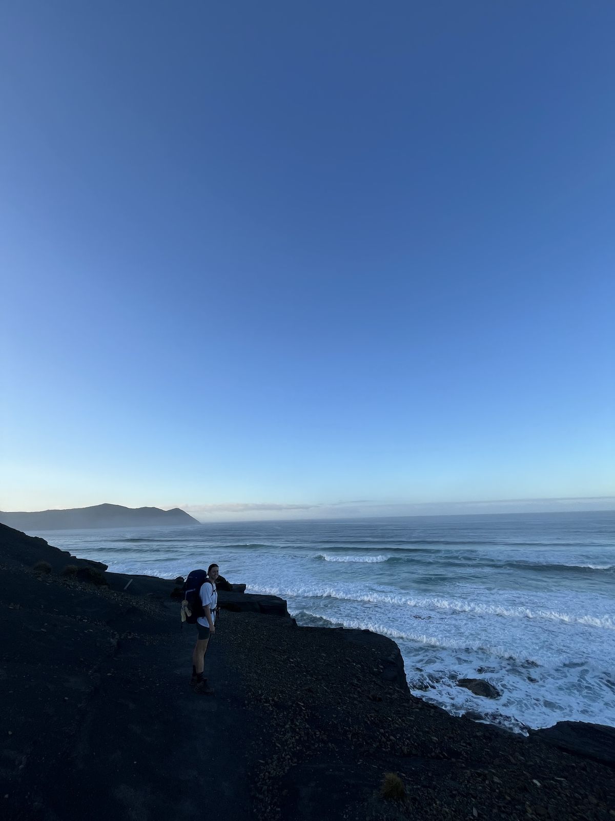
Days Six to Eight: Southern Beaches and Coastal Track
By day six, you're past the worst. The terrain becomes more coastal. The elevation gain reduces. Your body has adapted. Your legs don't hurt as much. You're sleeping better (still cold, but better). On my first trip, day six was the first morning I woke up and didn't immediately think, "I hate everything." That's progress.
These days are long walks on beaches and coastal tracks. You're seeing coastline that maybe 200 people a year ever lay eyes on. Beaches with zero footprints. The walking is straightforward and your body finally feels like it knows what it's doing.
The challenge becomes mental. You're not running on adrenaline anymore. You're just moving. Your mind has time to wander. This is actually nice. I found myself thinking about things I hadn't thought about in months. Not heavy stuff. Just random memories, old conversations, things I wanted to cook when I got home. The exhaustion is still there, but it's manageable. Your body has found its gear and it just keeps going.
By day seven on my first trip, I'd lost noticeable weight. I could see it in my arms and feel it in how my pack sat on my hips. I'd undercalculated food by at least two days' worth of calories. I was rationing trail mix and eating half portions of dehydrated meals. This is a mistake you only make once.
Water is plentiful. Camps are reasonable. Weather is usually a bit more settled by this point (not always, but usually).
Days six to eight combined: - Total Distance: 30-35 km over three days - Total Elevation: 500-600 metres - Difficulty: Moderate - Sleep Quality: Good - Food: You might be rationing by now if you miscalculated
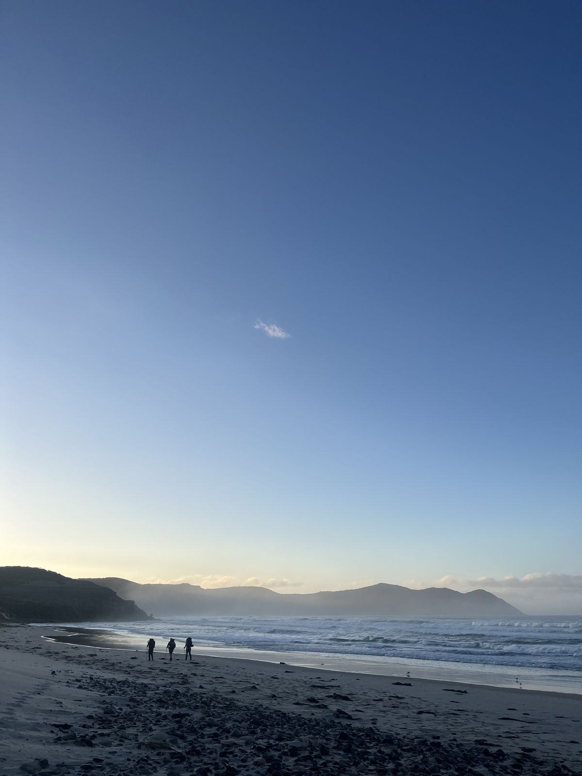
Days Nine to Ten: Prion Beach to Cockle Creek
Prion Beach is long and straight. On my first trip, I walked it in the morning and it felt endless. On my second trip, my partner and I walked it in the afternoon and it felt meditative.
The beach itself stopped me in my tracks. White sand, water so clear you can see the bottom, mountains framing everything behind you. Walking 20 kilometres along a beach where the only footprints are yours does something to your head that's hard to explain until you've done it.
The final camp (usually around day nine) is somewhere near the end of Prion Beach or on the Cockle Creek approach. On my first trip, I camped at the Prion Beach end and woke up at 4am because I was too excited to sleep. The idea of being done, of hot food and a shower and a bed, was almost overwhelming. I packed in the dark and started walking before dawn.
The last day (day ten) is a final walk to Cockle Creek and the road end where the ranger meets you with a vehicle. The terrain is easy. The distance is short. Your body knows it's almost done and finds energy it didn't have on day eight. I walked the final section faster than I'd walked anything since day one.
The Cockle Creek road end is anticlimactic in the best way. A small car park. A sign. A ranger who shakes your hand and asks if you made it alright. No fanfare. No medal. Just the quiet understanding between you and whoever else is there that you've all just done something most people never will.
On my second trip, there was another couple finishing at the same time. We'd never met on the track but we stood there nodding at each other like veterans who'd shared the same war. Nobody had to explain what the last 10 days had been like. Everyone knew. That silent recognition was worth more than any congratulations. We exchanged numbers. Never called. Didn't need to. The shared experience said everything.
By this point, your body is destroyed and your mind is clear. You walk the final kilometres knowing the track is done. Some people feel sad. Some feel relieved. Most feel both.
On my second trip, we walked the last 5 kilometres holding hands and not talking. There was nothing to say. The track had said it all. The feeling at Cockle Creek was similar to finishing a marathon, except you've been running it for 10 days and you smell significantly worse.
Days nine to ten combined: - Total Distance: 20-25 km - Total Elevation: 200 metres - Difficulty: Easy - Sleep Quality: Good (if you can sleep knowing it's almost done) - Food: You should have enough left
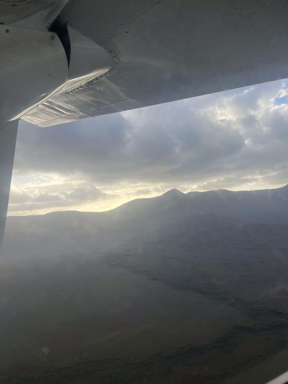
The Return Flight
You'll be picked up by the Par Avion plane from Cockle Creek on your designated day. The return flight is the same as the way in: bumpy, loud, and surreal because you're leaving. Ten days of silence replaced by engine noise and the slow return of phone signal. You're returning to normal life after being completely disconnected.
The contrast is jarring. You go from no shower for 10 days to airport bathrooms and civilization. You go from silence to noise. From extreme simplicity to overwhelming choice.
I remember the confusion the second time walking through Hobart Airport. Everything seemed excessive. Too much choice. Too much noise. Too many people. My partner stood in front of a vending machine for about two minutes just staring at the options. Ten days of "do I eat pasta or rice" doesn't prepare you for 40 drink choices. This passes within a day or two.
The guidebook (John Chapman South Coast Track guidebook) covers the route in detail. I'd recommend buying it even if you read this guide cover to cover, because having a physical map and elevation profile in your hands when you're lost and wet is invaluable. Digital maps on your phone are useless when your phone is dead.
Total Figures
- Total Distance: 86-91 km
- Total Elevation Gain: 2000-2500 metres (the track goes up and down constantly)
- Duration: 8-10 days typically
- Actual Walking Time: Roughly 8-10 hours per day on average
- Rest Days: Most people don't take full rest days. You walk every day but distance varies by day.
New dispatches from the field
Real stories. No spam. Unsubscribe anytime.